Core Summary & The Golden Nugget
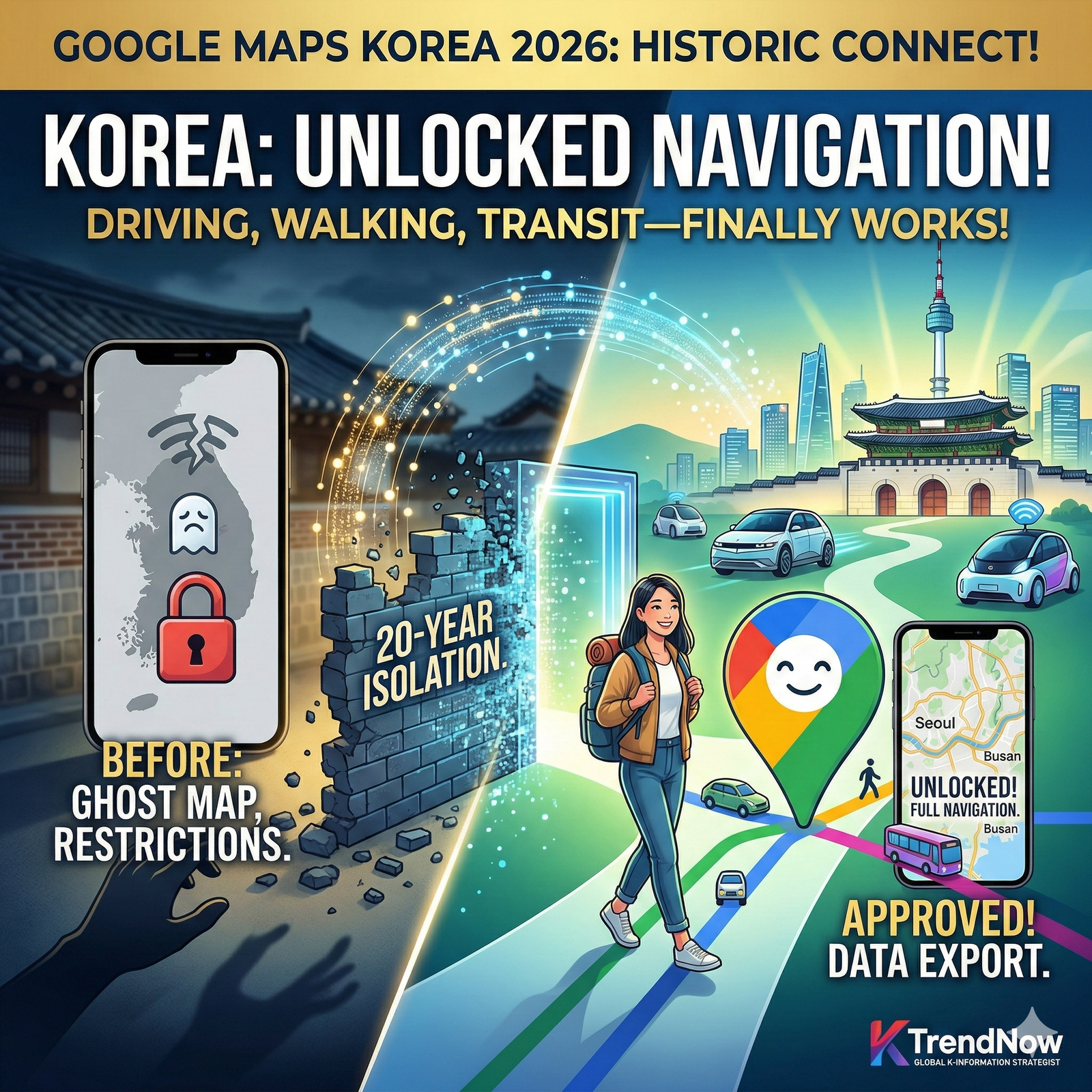
- As of February 2026, the South Korean government has finally approved the export of high-definition map data to Google after a 20-year security-based restriction.
- Travelers can now enjoy seamless turn-by-turn driving directions, detailed walking paths, and real-time traffic updates directly on Google Maps without needing third-party local apps.
- This historic shift transforms South Korea from a “digital island” into a globally integrated smart tourism hub, making navigation in Seoul as easy as in New York or London.
The One Thing to Remember
You no longer need to struggle with Korean-only navigation apps like Naver or Kakao; Google Maps now offers the full, gold-standard experience across the entire Korean peninsula.
The Deep Dive: Why Google Maps in Korea was “Broken” and How 2026 Changed Everything
For over two decades, South Korea was a unique outlier in the digital world. Due to national security concerns stemming from the ongoing conflict with the North, the government prohibited the export of high-resolution map data to foreign companies that did not have local servers or comply with strict censorship of military sites. While residents used local powerhouses like Naver Maps, global tourists often found Google Maps to be a frustrating “ghost map” with no walking or driving directions.
Detailed Comparison: Navigating Korea in 2026
| Feature | Google Maps (New 2026) | Local Apps (Naver/Kakao) | Global Traveler Impact |
| Driving Navigation | Full Support with Real-time AI | Full Support | Seamless car rentals and driving trips |
| Walking Directions | High-Precision | High-Precision | No more getting lost in Seoul’s alleys |
| Language & UI | Global Standard (Multilingual) | Limited English / Local focus | 100% intuitive for international users |
| Public Transport | Live Integration | Live Integration | Real-time bus/subway tracking |
| Offline Access | Map Downloads Allowed | Restricted | Critical for saving data roaming costs |
Why This Matters for the Global Community
The 2026 data export approval is not just a technical update; it is a massive economic catalyst.
- Boosting the “K-Workation” Trend: With full navigation restored, digital nomads can confidently explore rural hidden gems far beyond the Seoul metropolitan area, knowing they have a reliable guide in their pocket.
- Leveling the Playing Field for Local Businesses: Small restaurants and boutiques in “K-Alleys” will now see a surge in global visibility as Google Maps’ massive review database becomes a primary discovery tool for tourists.
- Accelerating the Future of Mobility: The availability of high-def map data allows global autonomous vehicle companies to integrate South Korean roads into their global networks, paving the way for international self-driving services in Incheon and Seoul.
Action Plan: Navigating Korea Like a Local
Step 1: Update your Google Maps app before your flight to ensure the latest 2026 Korea regional data is synced.
Step 2: Save your “Home” and “Work” (or Hotel) addresses immediately. The search functionality for English addresses has been significantly improved with the new data export.
Step 3: Utilize the “Live View” AR feature. This is particularly helpful in complex underground shopping malls in Myeongdong or Gangnam where traditional GPS might struggle.
FAQ: Common Concerns for Global Visitors
Q1: Is it completely safe to use Google Maps near the border (DMZ)?
Yes. The 2026 agreement includes a sophisticated AI blurring system that protects sensitive military installations while providing 100% accurate road and civilian data for users.
Q2: Do I still need to download Naver Maps?
For 95% of travelers, Google Maps is now sufficient. However, if you want to use specific features like “Order Ahead” for coffee or view highly detailed indoor floor plans of department stores, local apps still hold a slight edge in integration.
Q3: Will my saved places from years ago work now?
Yes! Any pins you dropped in the past will now correctly show full routing and navigation data instead of just a static point on the map.
Global Engagement Question
Now that the “digital wall” has fallen, which hidden corner of South Korea are you most excited to explore using Google Maps? Have you ever had a funny or frustrating experience trying to navigate a foreign country without a working map? Share your stories below!